


- Semiconductor Technology Now
Motorization, Act II — The Age of Automated Driving
Report Series
Quazi-zenith satellite improves positioning accuracy to a fraction of a meter
The Google Car is also equipped with a satellite-based global positioning system (GPS) used for in-car navigation, a distance measuring instrument (DMI) that counts wheel revolutions, and a 6-axis inertial measurement unit (IMU) for detecting vehicle attitude. The DMI and IMU units augment the GPS in a tunnel or other locations where satellite signals cannot reach. The IMU combines a 3-axis accelerometer and a 3-axis angular rate sensor, and compensates for the diminished accuracy of DMI when the vehicle changes its speed and/or attitude. Some automakers plan on using an IMU that also combines a 3-axis geomagnetic sensor.
In Japan, a new technology for improving the accuracy of GPS is being studied. Current GPS accuracy is 10 meters or more, which is too broad to determine the lane a car is on. To improve the accuracy to a fraction of a meter, the use of the quasi-zenith satellite system (Michibiki) operated by the Japan Aerospace Exploration Agency (JAXA) is being considered. As the satellites on the quasi-zenith orbits remain near the zenith of specific regions for relatively long periods, the GPS based on these satellites can ensure good signal reception even in urban areas where high-rises crowd the sky.
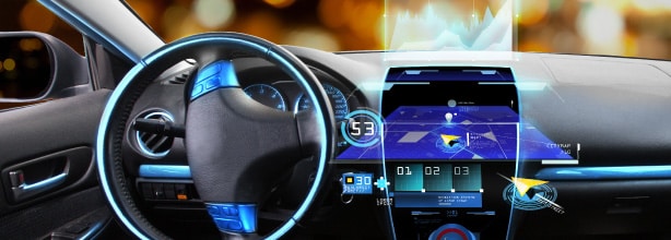
Use of image data simplifies sensor configuration
Recent automated driving systems often use a camera to capture images as part of the data collection process, a feature that was unavailable with the earliest version of Google Car. The image data contain information similar to the data detectable by radar devices, as well as other information that can only be captured by a camera, such as speed limit signs and construction signs.
The advancement in image sensing technology has significantly improved the resolution, dynamic range, speed of data capture, and nighttime photography, while also reducing the size and cost of a camera. As a result, a trend to consolidate the sensors and simplify the data collection system is gaining strength, instead of using a diverse array of sensors. The use of image data captured by cameras requires an improved system for analysis and recognition, which will be discussed later in this article.
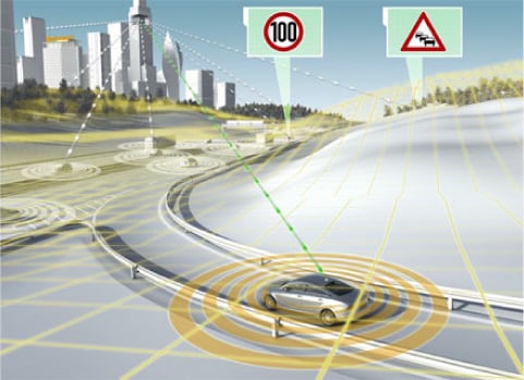
Efforts to standardize road-to-vehicle and inter-vehicular communications
Wireless data exchange among vehicles and/or between a vehicle and roadside infrastructures needs to be in compliance with the national and local regulations on wireless communications. Efforts to standardize wireless technologies for automated driving have already begun in various countries and regions. Typically, technologies that feature low latency, stable in-transit transmission, and robust weather resistance are preferred.
There are two sets of standards that apply to Japan: the Dedicated Short Range Communications (DSRC) standard that governs the use of the 5.8 GHz band for the country's Intelligent Transportation System (ITS), and one formulated in 2011 that governs the 700 MHz band (Figure 4). In the U.S. and Europe, the DSRC regulates the 5.9 GHz band and has been adopted as the IEEE 802.11p standard for Wi-Fi technology. There are also moves to apply 4G and other existing mobile communication technologies to vehicular data communications on a limited basis.
| System name | Frequency band | Communication mode | Purpose | Year of establishment |
|---|---|---|---|---|
| VICS: Vehicle Information and Communication System | 76 - 90Mhz | FM broadcasting | Traffic data service | 1994 |
| 2.5Ghz band | Road-to-vehicle communications | |||
| ETC: Electronic Toll Collection system | 5.8Ghz band | Road-to-vehicle communications | Automated toll collection | 1997 |
| DSRC: Dedicated Short Range Communications | 5.8Ghz band | Road-to-vehicle communications | ITS Spot service | 2001 |
| 700 MHz band ITS: 700 MHz band Intelligent Transportation System | 700Mhz band | Inter-vehicular communications | Driver support information service | 2011 |
| Road-to-vehicle communications |
 |
DSRC has already been adopted in Japan as road-to-vehicle communication standards for such roadside infrastructures as the Electronic Toll Collection (ETC) system on expressways. It has also been used in a technology development project by the New Energy and Industrial Technology Development Organization (NEDO) to facilitate inter-vehicular communications using the 5.8 GHz band. The system was tested successfully on a convoy of self-driving trucks to follow a human-driven lead truck, while maintaining a safe trailing distance. The trucks wirelessly exchange their own location data to ensure they stay in line. In Europe and the U.S., the wireless access in vehicular environments (WAVE) standard is expected to be applied to inter-vehicular communications. In the U.S., all new vehicles will have to be standard-equipped with a WAVE-based communication device starting as early as in 2017.
Japan uses a proprietary inter-vehicular communications technology that uses the 700 MHz band. This wavelength band is also known as the platinum band, because signals in this band can navigate around obstacles such as buildings and enable communication with vehicles that are not in a direct line of sight. The technology is also expected to be applied to pedestrian-to-vehicle communications, as well as to emergency ad hoc networks that offer an alternative means of communication when mobile and other phone services are down in a disaster situation.
Contents
Cross Talk
Visiting Laboratories
Expert Interview
Topics
Report Series
- Motorization, Act II – The Age of Automated Driving

- How Society Will Change in the Digital Age
- Part 1
- What is Digitalization?

- Sports Technology Protecting Athletes and Providing Fairer Refereeing